


Metrikler
Yayın
41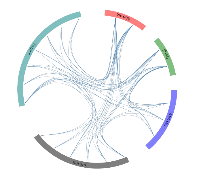
Açık Erişim
1
BM Sürdürülebilir Kalkınma Amaçları


Duyurular & Dokümanlar
Ders Notu
Surveying-III
Ders Notu
31.03.2026
Surveying-II
Ders Notu
24.03.2026
Surveying-I
Ders Notu
22.02.2026
Dosya İndir
Eğitim Bilgileri
2024 - 2025
2024 - 2025Post Doktora
Universiteit Twente, Faculty of Geo-Information Science and Earth Observation (ITC), Department of Natural Resources, Hollanda
2016 - 2020
2016 - 2020Doktora
Karadeniz Teknik Üniversitesi, Fen Bilimleri Enstitüsü, Harita Mühendisliği, Türkiye
2014 - 2016
2014 - 2016Yüksek Lisans
Karadeniz Teknik Üniversitesi, Fen Bilimleri Enstitüsü, Harita Mühendisliği / Uzaktan Algılama, Türkiye
2009 - 2014
2009 - 2014Lisans
Karadeniz Teknik Üniversitesi, Mühendislik Fakültesi, Harita Mühendisliği, Türkiye
Yaptığı Tezler
2020
2020Doktora
Metaheuristic Pansharpening Based on Symbiotic Organisms Search Optimization
Karadeniz Teknik Üniversitesi, Mühendislik Fakültesi, Harita Mühendisliği
2016
2016Yüksek Lisans
iHA TABANLI 3 BOYUTLU NOKTA BULUTLARINDA ZEMİN ÜSTÜ NOKTA FİLTRELEME ALGORİTMALARININ VE SAM ÜRETME YÖNTEMLERİNİN KARŞILAŞTIRILMASI
Karadeniz Teknik Üniversitesi, Fen Bilimleri Enstitüsü, Harita Mühendisliği / Uzaktan Algılama
Yabancı Diller
B2 Orta Üstü
B2 Orta Üstüİngilizce
Araştırma Alanları
Harita Mühendisliği-Geomatik
Uzaktan Algılama
Mühendislik ve Teknoloji
Akademik Faaliyetlere Dayalı Araştırma Alanları
Avesis Araştırma Alanları
WoS Araştırma Alanları
Scopus Araştırma Alanları
Akademik Ünvanlar / Görevler
2026 - Devam Ediyor
2026 - Devam EdiyorDoç. Dr.
Karadeniz Teknik Üniversitesi, Mühendislik Fakültesi, Harita Mühendisliği
2022 - 2026
2022 - 2026Dr. Öğr. Üyesi
Karadeniz Teknik Üniversitesi, Mühendislik Fakültesi, Harita Mühendisliği
2020 - 2022
2020 - 2022Araştırma Görevlisi Dr.
Karadeniz Teknik Üniversitesi, Mühendislik Fakültesi, Harita Mühendisliği
2015 - 2020
2015 - 2020Araştırma Görevlisi
Karadeniz Teknik Üniversitesi, Mühendislik Fakültesi, Harita Mühendisliği
Makaleler
Tümü (20)
SCI-E, SSCI, AHCI (12)
SCI-E, SSCI, AHCI, ESCI (13)
ESCI (1)
Scopus (13)
TRDizin (3)
Diğer Yayınlar (4)
2026
20261. Fusion of EnMAP/PRISMA hyperspectral and Sentinel-2 multispectral imagery for estimating crop traits
Yilmaz V., Şerifoğlu Yılmaz Ç., Belgiu M., Candiani G., Pepe M., Boschetti M., et al.
INTERNATIONAL JOURNAL OF REMOTE SENSING
, cilt.47, sa.4, ss.1699-1726, 2026 (SCI-Expanded, Scopus)


2025
20252. Assessment of Burned Area and Fire Severity Using Sentinel-2 Imagery: Case Studies from Türkiye’s Summer 2025 Wildfires
Şerifoğlu Yılmaz Ç.
Türk Uzaktan Algılama ve CBS Dergisi , cilt.6, sa.2, ss.300-314, 2025 (TRDizin)
2025
20253. Investigation of climate-related influences of dams on the Artvin province of Türkiye using remote sensing data
ŞERİFOĞLU YILMAZ Ç.
ENVIRONMENTAL EARTH SCIENCES
, cilt.84, sa.6, 2025 (SCI-Expanded, Scopus)

2023
20234. Automated detection of damaged buildings in post-disaster scenarios: a case study of Kahramanmaras (Turkiye) earthquakes on February 6, 2023
ŞERİFOĞLU YILMAZ Ç., YILMAZ V., Tansey K., Aljehani N. S. O.
NATURAL HAZARDS
, sa.3, ss.1247-1271, 2023 (SCI-Expanded, Scopus)
2023
20235. A Metaheuristic Optimization-Based Solution to MTF-GLP-Based Pansharpening
ŞERİFOĞLU YILMAZ Ç., GÜNGÖR O.
PFG-JOURNAL OF PHOTOGRAMMETRY REMOTE SENSING AND GEOINFORMATION SCIENCE
, cilt.91, sa.4, ss.245-272, 2023 (SCI-Expanded, Scopus)
2022
20226. Improving the Land Cover Mapping Accuracy of the Sentinel-2 Imagery on Google Earth Engine
Şerifoğlu Yılmaz Ç.
Turkish Journal of Remote Sensing and GIS , cilt.3, sa.2, ss.150-159, 2022 (Hakemli Dergi)
2022
20227. A theoretical and practical survey of image fusion methods for multispectral pansharpening
Yilmaz C. S., Yilmaz V., GÜNGÖR O.
INFORMATION FUSION
, cilt.79, ss.1-43, 2022 (SCI-Expanded, Scopus)
2021
20218. Çok bantlı görüntülerde pan-keskinleştirme üzerine bir inceleme
Şerifoğlu Yılmaz Ç., Yılmaz V., Güngör O.
Gümüşhane Üniversitesi Fen Bilimleri Enstitüsü Dergisi , cilt.11, sa.4, ss.1340-1357, 2021 (TRDizin)
2021
20219. Genetic algorithm-based synthetic variable ratio image fusion
Yilmaz V., Yilmaz Ç., GÜNGÖR O.
GEOCARTO INTERNATIONAL
, cilt.36, sa.9, ss.989-1006, 2021 (SCI-Expanded, Scopus)
2021
202110. The Effect of Point Density on Point Cloud Filtering Performance
Şerifoğlu Yılmaz Ç., Güngör O.
Turkish Journal of Remote Sensing and GIS , cilt.2, sa.1, ss.41-46, 2021 (Hakemli Dergi)
2020
202011. On the use of the SOS metaheuristic algorithm in hybrid image fusion methods to achieve optimum spectral fidelity
Yilmaz Ç., Yilmaz V., GÜNGÖR O.
INTERNATIONAL JOURNAL OF REMOTE SENSING
, cilt.41, sa.10, ss.3993-4021, 2020 (SCI-Expanded, Scopus)
2020
202012. Improving SVM Classification Accuracy with Image Fusion-Based Gabor Texture Features
Şerifoğlu Yılmaz Ç., Güngör O.
Turkish Journal of Remote Sensing and GIS , cilt.1, sa.1, ss.34-44, 2020 (Hakemli Dergi)
2020
202013. A genetic algorithm solution to the gram-schmidt image fusion
Yilmaz V., YILMAZ Ç., GÜNGÖR O., Shan J.
INTERNATIONAL JOURNAL OF REMOTE SENSING
, cilt.41, sa.4, ss.1458-1485, 2020 (SCI-Expanded, Scopus)
2019
201914. Metaheuristic pansharpening based on symbiotic organisms search optimization
Yilmaz Ç., Yilmaz V., GÜNGÖR O., Shan J.
ISPRS JOURNAL OF PHOTOGRAMMETRY AND REMOTE SENSING
, cilt.158, ss.167-187, 2019 (SCI-Expanded, Scopus)
2018
201815. LAND COVER MAPPING WITH ADVANCED CLASSIFICATION ALGORITHMS
ŞERİFOĞLU YILMAZ Ç., GÜNGÖR O., KAHRAMAN H. T.
Nature Sciences , cilt.13, sa.3, ss.41-50, 2018 (Hakemli Dergi)
2018
201816. Image classification-based ground filtering of point clouds extracted from UAV-based aerial photos
Yilmaz V., Konakoglu B., ŞERİFOĞLU YILMAZ Ç., GÜNGÖR O., GÖKALP E.
GEOCARTO INTERNATIONAL
, cilt.33, sa.3, ss.310-320, 2018 (SCI-Expanded, Scopus)
2018
201817. Comparison of the performances of ground filtering algorithms and DTM generation from a UAV-based point cloud
YILMAZ Ç., GÜNGÖR O.
GEOCARTO INTERNATIONAL
, cilt.33, sa.5, ss.522-537, 2018 (SCI-Expanded, Scopus)
2018
201818. Investigating the performances of commercial and non-commercial software for ground filtering of UAV-based point clouds
Yilmaz Ç., Yilmaz V., GÜNGÖR O.
INTERNATIONAL JOURNAL OF REMOTE SENSING
, cilt.39, sa.15-16, ss.5016-5042, 2018 (SCI-Expanded, Scopus)
2017
201719. Determination of Tree Crown Diameters with Segmentation of a UAS-Based Canopy Height Model
Yilmaz V., Yilmaz S. C., Tasci L., GÜNGÖR O.
IPSI BGD TRANSACTIONS ON INTERNET RESEARCH
, cilt.13, sa.2, 2017 (ESCI)
2016
201620. Using UAS-Based Point Clouds to Generate High Resolution Digital Terrain Model for Forestry Research and Applications
ŞERİFOĞLU YILMAZ Ç., YILMAZ V., GÜNGÖR O.
EUROPEAN JOURNAL OF FOREST ENGINEERING
, cilt.2, sa.1, ss.35-40, 2016 (Scopus, TRDizin)
Hakemli Bilimsel Toplantılarda Yayımlanmış Bildiriler
2024
20241. ASSESSING AIR POLLUTANT EMISSIONS IN THE AFTERMATH OF THE 2021 FOREST FIRES IN MARMARIS AND MANAVGAT, TÜRKİYE: INSIGHTS FROM SATELLITE-BASED MONITORING
ŞERİFOĞLU YILMAZ Ç.
8th International Conference on GeoInformation Advances, GeoAdvances 2024, İstanbul, Türkiye, 11 - 12 Ocak 2024, cilt.48, ss.329-336, (Tam Metin Bildiri)

2022
20222. ON THE USE OF TIME SERIES DATASETS THROUGH GOOGLE EARTH ENGINE TO MONITOR THE FOREST COVER LOSS IN TURKIYE BETWEEN 2001 AND 2021
Şerifoğlu Yılmaz Ç.
International Conference on Engineering Technologies, Konya, Türkiye, 17 - 19 Kasım 2022, ss.20-24, (Tam Metin Bildiri)
2020
20203. Kentsel Alanlardaki Değişimlerin Tespitinde Görüntü Kaynaştırma Yöntemlerinin Kullanımı
Şerifoğlu Yılmaz Ç., Yılmaz V., Güngör O.
II. Uluslararası Gayrimenkul Geliştirme ve Yönetimi Konferansı, Ankara, Türkiye, 30 Ocak - 02 Şubat 2020, (Tam Metin Bildiri)
2019
20194. A Semi-Automatic Approach to Collect Training Datasets for Ground Filtering
Şerifoğlu Yılmaz Ç., Yılmaz V., Güngör O.
International Symposium on Applied Geoinformatics (ISAG 2019), İstanbul, Türkiye, 7 - 09 Kasım 2019, ss.285-290, (Tam Metin Bildiri)
2019
20195. Investigation of Multiresolution Analysis-based Pansharpening Methods
Yılmaz V., Şerifoğlu Yılmaz Ç., Güngör O.
International Symposium on Applied Geoinformatics (ISAG 2019), İstanbul, Türkiye, 7 - 09 Kasım 2019, ss.280-284, (Tam Metin Bildiri)
2019
20196. Investigation of Multiresolution Analysis-based Pansharpening Methods
YILMAZ V., ŞERİFOĞLU YILMAZ Ç., GÜNGÖR O.
International Symposium on Applied Geoinformatics (ISAG2019), İstanbul, Türkiye, 7 - 09 Kasım 2019, ss.1-8, (Tam Metin Bildiri)
2019
20197. A Semi-Automatic Approach to Collect Training Datasets for Ground Filtering
ŞERİFOĞLU YILMAZ Ç., YILMAZ V., GÜNGÖR O.
International Symposium on Applied Geoinformatics (ISAG2019), İstanbul, Türkiye, 7 - 09 Kasım 2019, ss.1-8, (Tam Metin Bildiri)
2018
20188. Improving Hyperspectral Image Classification with Watershed Segmentation-Based Texture Features
Şerifoğlu Yılmaz Ç., Yılmaz V., Güngör O.
2nd International Symposium on Innovative Approaches in Scientific Studies, Samsun, Türkiye, 30 Kasım - 02 Aralık 2018, ss.1, (Tam Metin Bildiri)
2018
20189. Modified Synthetic Variable Ratio Pansharpening Method
Yılmaz V., Şerifoğlu Yılmaz Ç., Güngör O.
2nd International Symposium on Innovative Approaches in Scientific Studies, Samsun, Türkiye, 30 Kasım - 02 Aralık 2018, ss.1, (Tam Metin Bildiri)
2017
201710. Texture Based Classification of Hyperspectral Images with Support Vector Machines Classifier
ŞERİFOĞLU YILMAZ Ç., TUNÇ GÖRMÜŞ E., GÜNGÖR O.
INTERNATIONAL SYMPOSIUM ON GIS APPLICATIONS IN GEOGRAPHY & GEOSCIENCES (ISGGG), Çanakkale, Türkiye, 18 - 20 Ekim 2017, ss.88, (Tam Metin Bildiri)
2017
201711. Land Cover Mapping with Advanced Classification Algorithms
ŞERİFOĞLU YILMAZ Ç., GÜNGÖR O., KAHRAMAN H. T.
International Conference on Advanced Engineering Technologies (ICADET) 2017, Bayburt, Türkiye, 21 - 23 Eylül 2017, ss.1, (Tam Metin Bildiri)
2017
201712. Integration of Thematic Information to UAV-Based Point Clouds for Ground Filtering
Yılmaz V., Şerifoğlu Yılmaz Ç., Güngör O.
International Conference on Advances and Innovations in Engineering (ICAIE) 2017, Elazığ, Türkiye, 10 - 12 Mayıs 2017, ss.618-621, (Tam Metin Bildiri)
2017
201713. Ground Filtering of a UAV-based Point cloud with the Cloth Simulation Filtering Algorithm
Şerifoğlu Yılmaz Ç., Yılmaz V., Güngör O.
International Conference on Advances and Innovations in Engineering (ICAIE) 2017, Elazığ, Türkiye, 10 - 12 Mayıs 2017, ss.627-630, (Tam Metin Bildiri)
2016
201614. Performance Comparison of Different Interpolation Techniques in Generation of DTMs from UAV-Based Point Clouds
ŞERİFOĞLU YILMAZ Ç., GÜNGÖR O.
The Selçuk International Scientific Conference On Applied Sciences - 2016, Antalya, Türkiye, 27 - 30 Eylül 2016, ss.1-6, (Tam Metin Bildiri)
2016
201615. Performance Evaluation of Different Ground Filtering Algorithms for UAV-based Point Clouds
ŞERİFOĞLU Ç., GÜNGÖR O., YILMAZ V.
International Society for Photogrammetry and Remote Sensing 2016 (ISPRS 2016), Prag, Çek Cumhuriyeti, 12 - 19 Temmuz 2016, cilt.XLI-B1, ss.245-251, (Tam Metin Bildiri)
2016
201616. Determining Stand Parameters from UAS-based Point Clouds
Yılmaz V., Şerifoğlu Ç., Güngör O.
International Society for Photogrammetry and Remote Sensing 2016 (ISPRS 2016), Praha, Çek Cumhuriyeti, 12 - 19 Temmuz 2016, cilt.XLI-B1, ss.413-416, (Tam Metin Bildiri)
2016
201617. High Resolution Digital Terrain Model Generation from UAS-Based Point Clouds
Şerifoğlu Ç., Yılmaz V., Güngör O.
1st International Symposium of Forest Engineering and Technologies (FETEC 2016), Bursa, Türkiye, 2 - 04 Haziran 2016, ss.1-9, (Tam Metin Bildiri)
2016
201618. PERFORMANCE EVALUATION OF DIFFERENT GROUND FILTERING ALGORITHMS FOR UAV-BASED POINT CLOUDS
Serifoglu Ç., Gungor O., Yilmaz V.
23rd Congress of the International-Society-for-Photogrammetry-and-Remote-Sensing (ISPRS), Prague, Çek Cumhuriyeti, 12 - 19 Temmuz 2016, cilt.41, ss.245-251, (Tam Metin Bildiri)
Desteklenen Projeler
2017 - 2018
2017 - 2018Boyut İndirgeme Yöntemlerinin Hiperspektral Görüntülerin Sınıflandırılmasına Olan Etkilerinin Araştırılması
Yükseköğretim Kurumları Destekli Proje , BAP Diğer
TUNÇ GÖRMÜŞ E. (Yürütücü), GÜNGÖR O., ŞERİFOĞLU YILMAZ Ç., SARALIOĞLU E.
Bilimsel Kuruluşlardaki Üyelikler / Görevler
2020 - Devam Ediyor
2020 - Devam EdiyorThe International Society for Photogrammetry and Remote Sensing (ISPRS)
Üye
Kongre ve Sempozyum Katılımı Faaliyetleri
01 Eylül 2016 - 01 Eylül 2016
01 Eylül 2016 - 01 Eylül 2016The Selçuk International Scientific Conference On Applied Sciences 2016 (ISCAS 2016)
Katılımcı
Antalya-Türkiye
01 Temmuz 2016 - 01 Temmuz 2016
01 Temmuz 2016 - 01 Temmuz 2016International Society for Photogrammetry and Remote Sensing 2016 (ISPRS 2016)
Katılımcı
Praha-Çek Cumhuriyeti
01 Haziran 2016 - 01 Haziran 2016
01 Haziran 2016 - 01 Haziran 2016