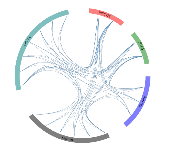
Yayınlar & Eserler

SCI, SSCI ve AHCI İndekslerine Giren Dergilerde Yayınlanan Makaleler

Diğer Dergilerde Yayınlanan Makaleler

Hakemli Kongre / Sempozyum Bildiri Kitaplarında Yer Alan Yayınlar

Investigation of Multiresolution Analysis-based Pansharpening Methods

International Symposium on Applied Geoinformatics (ISAG2019), İstanbul, Türkiye, 7 - 09 Kasım 2019, ss.1-8

A Semi-Automatic Approach to Collect Training Datasets for Ground Filtering

International Symposium on Applied Geoinformatics (ISAG2019), İstanbul, Türkiye, 7 - 09 Kasım 2019, ss.1-8

Improving Hyperspectral Image Classification with Watershed Segmentation-Based Texture Features

2nd International Symposium on Innovative Approaches in Scientific Studies, Samsun, Türkiye, 30 Kasım - 02 Aralık 2018, ss.1

Modified Synthetic Variable Ratio Pansharpening Method

2nd International Symposium on Innovative Approaches in Scientific Studies, Samsun, Türkiye, 30 Kasım - 02 Aralık 2018, ss.1

Texture Based Classification of Hyperspectral Images with Support Vector Machines Classifier

INTERNATIONAL SYMPOSIUM ON GIS APPLICATIONS IN GEOGRAPHY & GEOSCIENCES (ISGGG), Çanakkale, Türkiye, 18 - 20 Ekim 2017, ss.88

Land Cover Mapping with Advanced Classification Algorithms

International Conference on Advanced Engineering Technologies (ICADET) 2017, Bayburt, Türkiye, 21 - 23 Eylül 2017, ss.1

Kitle Kaynağın Uzaktan Algılamada Kullanımı

International Conference on Advanced Engineering Technologies, Bayburt, Türkiye, 21 - 23 Eylül 2017, ss.937

Crown Diameter Estimation with Segmentation Techniques

International Conference on Advanced Engineering Technologies (ICADET) 2017, Bayburt, Türkiye, 21 - 23 Eylül 2017, ss.322-327

Use of Crowdsourcing in Evaluating Post-Classification Accuracy

37Th EARseL Symposium 2017, Prag, Çek Cumhuriyeti, 27 - 30 Haziran 2017, ss.1

Ground Filtering of a UAV-based Point cloud with the Cloth Simulation Filtering Algorithm

International Conference on Advances and Innovations in Engineering (ICAIE) 2017, Elazığ, Türkiye, 10 - 12 Mayıs 2017, ss.627-630

Integration of Thematic Information to UAV-Based Point Clouds for Ground Filtering

International Conference on Advances and Innovations in Engineering (ICAIE) 2017, Elazığ, Türkiye, 10 - 12 Mayıs 2017, ss.618-621

PREDICTING FLOOD PLAIN INUNDATION FOR NATURAL CHANNELS HAVING NO GAUGED STATIONS

2nd IWA Regional Symposium on water, wastewater and environment, İzmir, Türkiye, 22 - 24 Mart 2017, ss.1-10

Evrişimsel sinir ağları ile görüntü sınıflandırma

8. Savunma Teknolojileri Kongresi, Ankara, Türkiye, 12 - 14 Ekim 2016, ss.1

Convolutional neural network classification for hazelnut plantation fields

International Scientific Congress on Applied Sciences, Antalya, Türkiye, 27 - 30 Eylül 2016, ss.1

Performance Comparison of Different Interpolation Techniques in Generation of DTMs from UAV-Based Point Clouds

The Selçuk International Scientific Conference On Applied Sciences - 2016, Antalya, Türkiye, 27 - 30 Eylül 2016, ss.1-6

Determining Stand Parameters from UAS-based Point Clouds

International Society for Photogrammetry and Remote Sensing 2016 (ISPRS 2016), Prag, Çek Cumhuriyeti, 12 - 19 Temmuz 2016, cilt.XLI-B1, ss.413-416 Sürdürülebilir Kalkınma

Performance Evaluation of Different Ground Filtering Algorithms for UAV-based Point Clouds

International Society for Photogrammetry and Remote Sensing 2016 (ISPRS 2016), Praha, Çek Cumhuriyeti, 12 - 19 Temmuz 2016, cilt.XLI-B1, ss.245-251

Determining Stand Parameters from UAS-based Point Clouds

International Society for Photogrammetry and Remote Sensing 2016 (ISPRS 2016), Praha, Çek Cumhuriyeti, 12 - 19 Temmuz 2016, cilt.XLI-B1, ss.413-416 Sürdürülebilir Kalkınma

Performance Evaluation of Different Ground Filtering Algorithms for UAV-based Point Clouds

International Society for Photogrammetry and Remote Sensing 2016 (ISPRS 2016), Prag, Çek Cumhuriyeti, 12 - 19 Temmuz 2016, cilt.XLI-B1, ss.245-251

Determining Stand Parameters from UAS-based Point Clouds

International Society for Photogrammetry and Remote Sensing 2016 (ISPRS 2016), Prag, Çek Cumhuriyeti, 12 - 19 Temmuz 2016, cilt.XLI-B1, ss.413-416

Performance Evaluation of Different Ground Filtering Algorithms for UAV-based Point Clouds

International Society for Photogrammetry and Remote Sensing 2016 (ISPRS 2016), Prag, Çek Cumhuriyeti, 12 - 19 Temmuz 2016, cilt.XLI-B1, ss.245-251

High Resolution Digital Terrain Model Generation from UAS-Based Point Clouds

1st International Symposium of Forest Engineering and Technologies (FETEC 2016), Bursa, Türkiye, 2 - 04 Haziran 2016, ss.1-9

Mineral Exploration with Hyperspectral Image Fusion

24th Signal Processing and Communication Application Conference (SIU), Zonguldak, Türkiye, 16 - 19 Mayıs 2016, ss.1281-1284 identifier identifier

Görüntü İşleme Teknikleri ile Ağaçların Boy, Tepe Çapı ve Tepe Hacimlerinin Belirlenmesi

TUFUAB 2015 Türkiye Ulusal Fotogrametri ve Uzaktan Algılama Birliği VIII. Teknik Sempozyumu, Konya, Türkiye, 21 - 23 Mayıs 2015, ss.320-323

Uzaktan Algılama Araştırmacılarına Yönelik Python Ara Yüzü ve ArcGIS Yazılımı Eklentisi

Uzaktan Algılama Ve Coğrafi Bilgi Sistemleri Sempozyumu (Uzal-Cbs 2014), İstanbul, Türkiye, 14 - 17 Ekim 2014, ss.1-5

UZAKTAN ALGILAMA ARAŞTIRMACILARINA YÖNELİK PYTHON ARA YÜZÜ VE ARCGIS YAZILIMI EKLENTİSİ

Uzaktan Algılama ve Coğrafi Bilgi Sistemleri Sempozyumu (UZAL-CBS 2014), İstanbul, Türkiye, 14 - 17 Ekim 2014, ss.1-7

Performance Analysis on Image Fusion Methods

CaGIS/ASPRS Specialty Conference, Texas, Amerika Birleşik Devletleri, 29 - 30 Ekim 2013, ss.1-12

Görüntü Kaynaştırma Yöntemlerinde Performans Analizi

TUFUAB 2013 Türkiye Ulusal Fotogrametri ve Uzaktan Algılama Birliği VII. Teknik Sempozyumu, Trabzon, Türkiye, 23 - 25 Mayıs 2013, ss.1-6

Eş Dizimlilik Matrisi Ve Rastgele Orman Sınıflandırıcısı İle Çay Ve Fındık Alanlarının Sınıflandırılması

Türkiye Ulusal Fotogrametri ve Uzaktan Algılama Birliği VII. Teknik Sempozyumu (TUFUAB’2013), Trabzon, Türkiye, 23 - 25 Mayıs 2013, ss.1-10 Sürdürülebilir Kalkınma

İnsansız Hava Aracı ile Üretilen Ortofoto Haritalarda Doğruluk Analizi

TUFUAB 2013 Türkiye Ulusal Fotogrametri ve Uzaktan Algılama Birliği VII. Teknik Sempozyumu, Trabzon, Türkiye, 23 - 25 Mayıs 2013

İnsansız Hava Aracı İle Üretilen Ortofoto Haritalarda Doğruluk Analizi

Türkiye Ulusal Fotogrametri ve Uzaktan Algılama Birliği VII. Teknik Sempozyumu (TUFUAB’2013), Trabzon, Türkiye, 23 - 25 Mayıs 2013, ss.1-6

Flood Risk Mapping for Pazarsuyu Creek, Giresun, Turkey, Using a Two-Dimensional Inertial Based Flood Inundation Model

10th International Congress on Advances in Civil Engineering, Ankara, Türkiye, 17 - 19 Ekim 2012, ss.1-10

Toplu Öğrenme Yöntemlerinin Performanslarının Karşılaştırılması: Rastgele Orman Ve Gentle Adaboost

Cumhuriyet Üniversitesi Geomatik Mühendisliği Bölümü Açılış Sempozyumu, Sivas, Türkiye, 17 - 19 Kasım 2011, ss.1-10 Sürdürülebilir Kalkınma

Rastgele Orman Sınıflandırıcısı ile Arazi Kullanım Alanlarının Belirlenmesi

III. Uzaktan Algılama ve Coğrafi Bilgi Sistemleri Sempozyumu, Kocaeli, Türkiye, 11 - 13 Ekim 2010, ss.142-152 Sürdürülebilir Kalkınma

Domain Land Use/Cover Data Model Enabling Multiple Use for Turkey

International Workshop on Spatial Information for Sustainable Management of Urban Areas, FIG Commission 3, Workshop, Mainz, Almanya, 2 - 04 Şubat 2009, ss.1-10 Sürdürülebilir Kalkınma

Kriter Tabanlı Görüntü Kaynaştırma Yöntemi

2. Uzaktan Algılama ve Coğrafi Bilgi Sistemleri Sempozyumu, Kayseri, Türkiye, 13 - 15 Ekim 2008, ss.1-9

Colour-Based and Criteria-Based Methods for Image Fusion

21th ISPRS (International Society for Photogrammetry and Remote Sensing) Conference, Beijing, Çin, 3 - 11 Temmuz 2008, ss.1057-1064

An Optimal Fusion Approach for Optical and SAR Images

ISPRS Commission VII Mid-term Symposium "Remote Sensing: From Pixels to Processes", Enschede, Hollanda, 8 - 11 Mayıs 2006, ss.111-116

A Statistical Approach for Multi-resolution Image Fusion

UPPECORA 16UP - "Global Priorities in Land Remote Sensing", Sioux Fall, South Dakota, Amerika Birleşik Devletleri, 23 - 27 Ekim 2005, ss.1-10

Performance Evaluation for Pan-sharpening Techniques

IEEE International Geoscience and Remote Sensing Symposium, Seul, Güney Kore, 25 - 29 Temmuz 2005, ss.4264-4266

A Comparative Study on Wavelet Transform Based Image Fusion Methods Using High Resolution Satellite Images

ASPRS 2005 Annual Conference "Geospatial Goes Global: From Your Neighborhood to the Whole Planet, Baltimore, Amerika Birleşik Devletleri, 7 - 11 Mart 2005, ss.1-12

Evaluation of Satellite Image Fusion Using Wavelet Transformation

20th ISPRS (International Society for Photogrammetry and Remote Sensing) Conference, İstanbul, Türkiye, 12 - 23 Temmuz 2004, ss.1-6

Evaluation of Real-Time Kinematic (RTK) GPS in Geodetic Applications

International Symposium on GIS, İstanbul, Türkiye, 15 - 18 Eylül 2002, ss.1-10

An Approach to Designing a Data Acqusition Dictionary in GPS/GIS Integration for Urbanization Projects

3rd International Symposium Remote Sensing of Urban Areas, İstanbul, Türkiye, 13 - 15 Haziran 2002

GPS'in Kent Bilgi Sistemi Uygulamalarındaki Yeri ve O¨nemi

Yerel Yönetimlerde Kent Bilgi Sistemi Uygulamaları, Trabzon, Türkiye, 13 - 15 Ekim 1999, ss.307-316

Kitap & Kitap Bölümleri

Detection and Management of Tea Farmland with Remote Sensing and GIS Technologies

RESEARCH & REVIEWS IN ENGINEERING, Başyiğit G.,Çiftçi A.,Yılmaz A., Editör, Gece Kitaplığı, Ankara, ss.5-23, 2019

Detection And ManagementOf Tea Farmland With RemoteSensing And GIs Technologies

RESEARCH REVIEWS IN ENGINEERING, Doç. Dr. Gülden BAŞYİĞİT KILIÇDr. Öğr. Üyesi Ahmet ÇİFÇİDr. Öğr. Üyesi Altan YILMAZ, Editör, Gece Kitaplığı, Ankara, ss.5-23, 2019

Detection And Management Of Tea Farmland With Remote Sensing And GIs Technologies

Research Reviews in Engineering, Doç. Dr. Gülden BAŞYİĞİT KILIÇ,Dr. Öğr. Üyesi Ahmet ÇİFÇİ,Dr. Öğr. Üyesi Altan YILMAZ, Editör, Gece Kitaplığı, Ankara, ss.5-23, 2019

Diğer Yayınlar

Metrikler

Yayın

96

Atıf (WoS)

376

H-İndeks (WoS)

11

Atıf (Scopus)

405

H-İndeks (Scopus)

12

Proje

5

Tez Danışmanlığı

13

Açık Erişim

14
BM Sürdürülebilir Kalkınma Amaçları